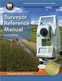
Surveyor

Surveyor Reference Manual

By - Cole, George M.
ISBN 10 - 1591264855
ISBN 13 - 9781591264859
Book Status - 5 Qnty Available with us.
Shelf No - 3
Call Number - 526.9 COL 2015
Edition - 6th ed
Physical Description - 1 volume (various pagings) : illustrations ; 28 cm
Notes - Includes Index
Book Information
*Add the convenience of accessing this book anytime, anywhere on your personal device with the eTextbook version for only $50 at ppi2pass.com/etextbook-program.* Get your Surveyor Reference Manual index at ppi2pass.com/downloads. An In-Depth Review of Surveying Exam Concepts Surveyor Reference Manual Sixth Edition The Surveyor Reference Manual is the most comprehensive book for the NCEES Fundamentals of Surveying (FS) exam. Its time-tested organization and clear explanations start with the basics to help you quickly get up to speed on common surveying concepts. Together, the 44 chapters provide an in-depth review of FS exam topics, and introduce many subjects covered on the Principles and Practice of Surveying (PS) exam. The extensive index contains more than 1000 entries, with multiple entries included for each topic, so you'll find what you're looking for no matter how you search. This book features: 10 appendices containing essential support material over 220 practice problems to build your problem-solving skills over 120 common surveying terms defined in an easy-to-use glossary hundreds of equations, figures, and tables industry-standard terminology and nomenclature example problems that demonstrate how to apply the concepts presented The Surveyor Reference Manual is a popular textbook for surveying courses, and after you pass your exam, it will continue to serve as an invaluable reference throughout your surveying career. Topics Covered Aerial Mapping Algebra and Trigonometry Basic Sciences Boundary Law, Cadastral Law, and Administration Business Law Computer Operations and Programming Data Adjustment Economics Field Data Acquisition and Reduction Finance Geodesy Geodetic Survey Calculation Geographic Information Systems (GIS) Graphical Communication, Mapping Higher Math Land Development Principles Laser Scanning Management Measurement Analysis Photo/Image Data Acquisition and Reduction Plane Survey Calculation Probability and Statistics Survey Astronomy Survey Planning Process and Procedures Written Communication

Open Book